

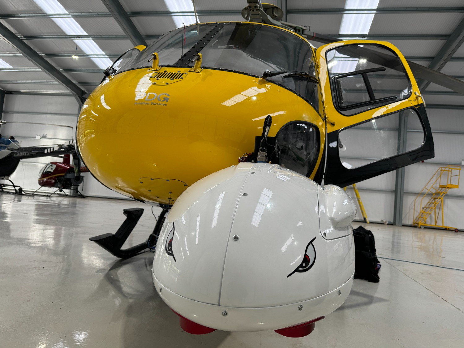
NETWORK Rail has been testing a powerful new helicopter camera system that combines high-resolution photography with laser surveys and near-infrared images to give its engineers an ‘incredible’ view of the network.
The multi-angle camera system (MACS) fits in a pod under the organisation’s Twin Squirrel helicopter, which is operated by Cumbernauld-based PDG, and can cover many miles of railway in a single shift, carrying a pilot and aerial surveyor.
The MACS’ onboard laser creates a ‘point cloud’ of up to 300 points per square metre, which can be used to build a 3D model of the railway, right down to overhead wires, bridges, and more.
Meanwhile, three 150 megapixel RGB cameras facing forward, sideways, and directly down take images, which are geometrically corrected to make them useful for engineering purposes, while a fourth takes near-infrared images – which can be used to determine plant and tree health.
The system can also provide digital terrain maps without trees or buildings to help geotechnical engineers to see the railway clearly and understand the nature of any failures and even take action before a failure.
Sean Leahy, of Network Rail Air Ops, said, “Passengers and freight customers deserve a reliable railway and the best way to provide that is to know as much about our network as we can, to spot problems before they happen and maintain it to the highest standards. We have brilliant colleagues who are able to work wonders but they can’t be everywhere on the 20,000 miles of track we look after. The MACS is one of the ways we can help them by giving them the best data we can.”
Bradley Sparkes, of Network Rail’s technical authority team, added, “We operate one of the busiest railways in the world, with over seven million train movements per year making traditional boots-on-ballast inspections a real challenge. When we do ultimately decide to send an engineer on-site for a closer inspection, we need to be sure we’re basing such a deployment on comprehensive and robust prior intelligence. This will help to drive a reduction in inspection related emissions, improvements in worker safety and enhanced asset intelligence.”
Data from the MACS will provide a solid foundation on which machine learning algorithms for an array of disciplines could be trained. Network Rail added that this will help path the way for the utilisation of survey-grade drones, which will be able to fly increasingly long distances as Beyond Visual Line of Sight (BVLOS) capabilities mature.
The MACS will be offered to Network Rail regions for their use as part of the suite of equipment that can be carried by the helicopter, from thermal imagine to standard cameras.